Dromedary Days

Some time back I posted Dick Callum – Pioneer Mountain Biker? which referenced a passage in Pigeon Post about Dick’s wild ride downhill on a ‘dromedary’—alternatively “a girl’s bike two sizes too big for him”.

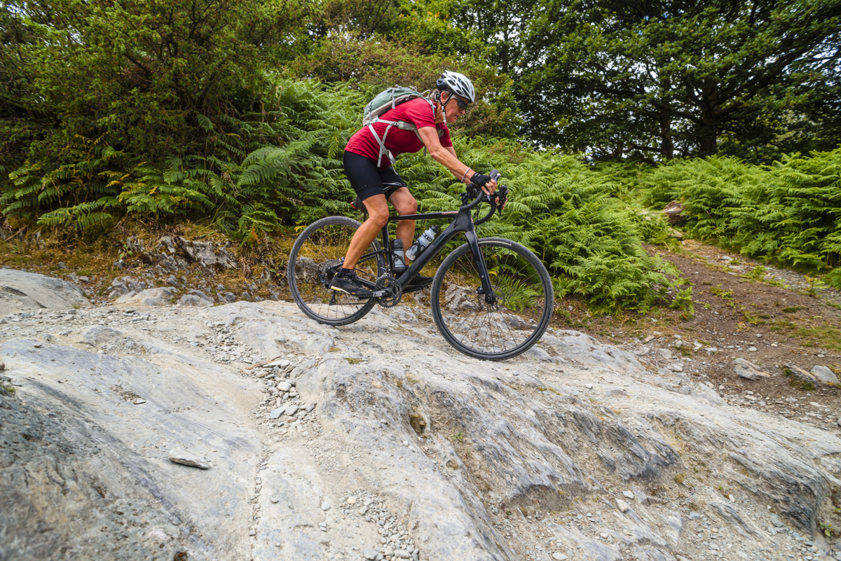
That was in 2014, before recent developments in off-road riding, especially the advent of the gravel bike. For the uninitiated, a gravel bike may superficially resemble a road bike but with space for fatter tyres and with adjustments to the setup to make it more forgiving on rougher trails. (For more see this link by my friend and colleague Chiz Dakin, or just Google ‘what is a gravel bike?’).

Easy going on the Windermere ride, with ‘Grey Screes’ (Wetherlam) filling the horizon.

My partner and I acquired gravel bikes a few years ago and have had enormous fun exploring trails in the Lakes and elsewhere with them. They obviously aren’t as capable on really steep or rough trails as a genuine mountain bike (but I’d take my gravel bike over the average ‘supermarket special’ any day). Where they really shine is when you need use tarmac to link sections of trail, where a gravel bike really skims along compared to an MTB.

With years of mountain biking as well as riding various trails on cyclo-cross bikes and more recently gravel bikes, I felt I had something to contribute when I was approached by Out There Guides, an imprint of Northern Eye Books, who were branching out beyond their very successful walking books into cycling. After discussion with publisher Carl Rogers and series editor Tom Hutton, we decided to focus on what we later called “the often-overlooked gap between easy forest roads and hardcore mountain biking.” 

While a modern gravel bike is ideal for these rides, they would also be possible on a range of other bikes. As I say in the book, “Any kind of mountain bike (MTB) will serve you well, though full-suspension bikes especially are heavier than gravel bikes. A good quality hybrid bike is also a possibility, but you might want to try it on one of the easier rides first.” I could also have mentioned cyclo-cross bikes and good solid old-school touring bikes, but space was tight.

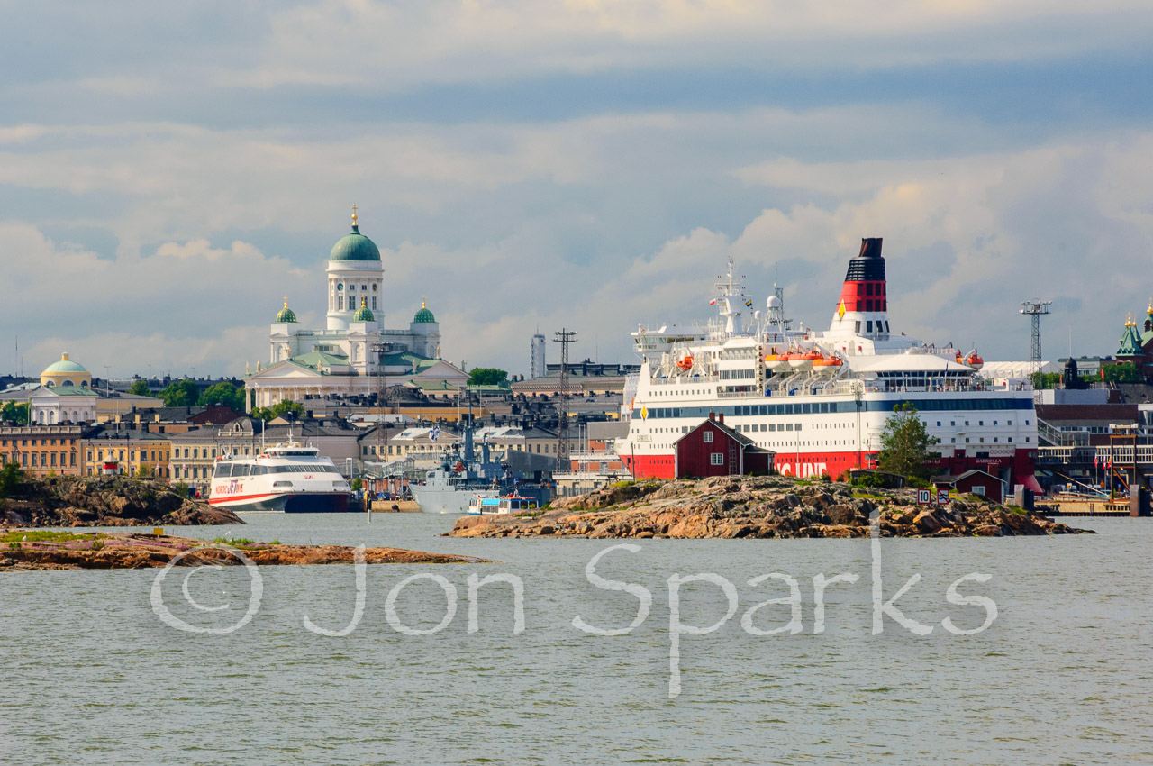
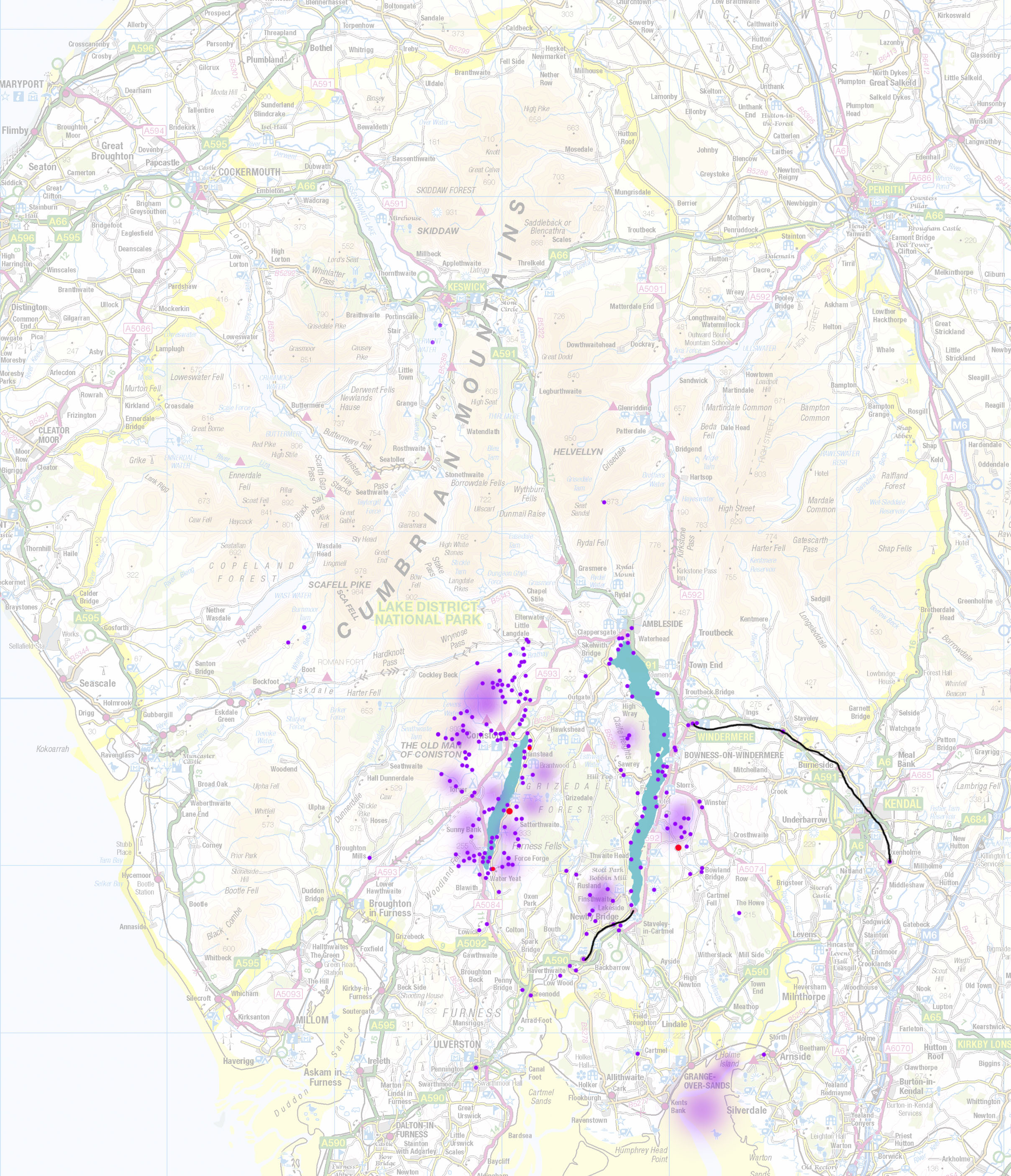
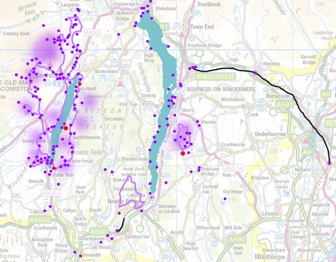
Obviously there was a lot of exploring and route-checking to be done, but I already had a pretty good idea of where most of the rides were likely to be, and most of them were in or close to Ransome country. This isn’t bias on my part; geology and history have combined to create a richer network of trails in this southern quadrant of the National Park than elsewhere.

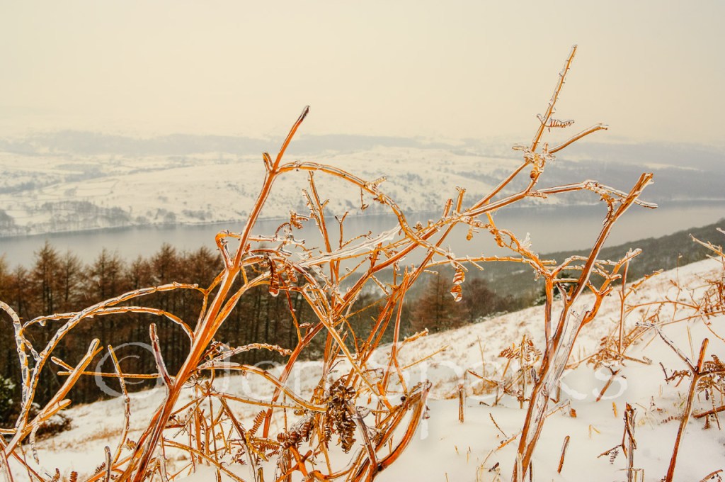
Most obviously, there’s a ride from Coniston around the Tilberthwaite area. With its extensive and fascinating old quarries, it’s rich in the atmosphere of Pigeon Post—but did Ransome have any of these trails specifically in mind when he wrote “the dromedary was jolting (Dick) almost to pieces as it slipped and jumped and jibbed and skidded and bucked over the loose stones in the old path down the wood”? Maybe, maybe not. I never felt like I was being ‘jolted almost to pieces’ on any of these trails, and I don’t think that’s all down to the superiority of modern bikes.

A technical moment on the Tilberthwaite ride

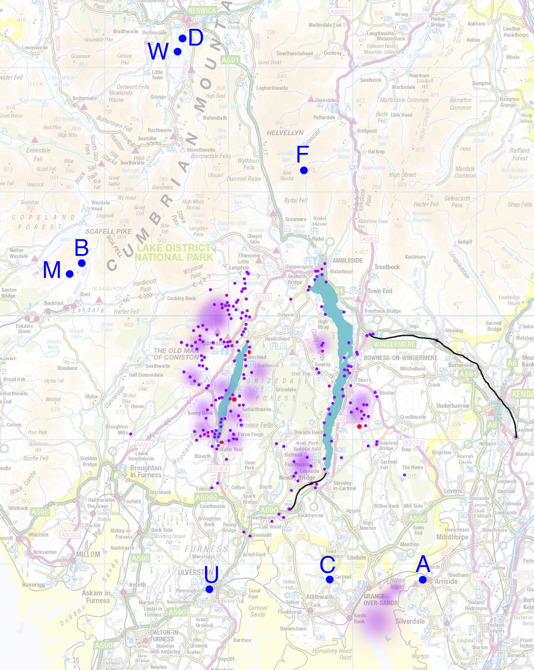
Another ride with a connection to AR’s life, though not obviously to the landscape of the books, takes you around the Cartmel valley. At one point it passes very close to Wall Nook, where AR stayed as a young man and from where he sometimes set out on epic walks to Coniston (and back) to call on the Collingwood family. However the real highlight of this ride is the trail along the flanks of Hampsfell before the end.

The trail along the flanks of Hampsfell

Deep in the heart of Ransome country, there’s also a ride along the west shore of Windermere and back via Hawkshead. In a much quieter corner a few miles to the west and south is the ride from Blawith over Subberthwaite Common. At one point this ride isn’t terribly far from Lowick Hall, where AR and Evgenia lived for a while, so he may have known the lanes, though by this stage in his life I’m sure he wouldn’t have been taking a dromedary over the tracks. There are steep climbs here, but on tarmac, while the off-road stuff is all pretty amenable, and takes you past some fascinating archaeological sites, both prehistoric and mediaeval.

A fabulous trail on Subberthwaite Common

I’d also like to mention the first volume in the ‘Great Bike Rides’ series, which has been out for some months already. This is ‘Family Cycle Rides in the Lake District’ by Alf Alderson, and does pretty much what it says on the tin. There’s partial overlap with a few of my rides but nothing to worry about. I had some editorial input into this one and provided quite a number of photos.

Either (or both!) of these books offer plenty of inspiration to explore the lake country by bike. It really is one of the best ways to see the district, and I don’t think Arthur Ransome would have had any quarrel with that.

Arthur Ransome in the Baltic

I know it’s not the Lake District, but I thought it would be interesting to take a look at the place of the Baltic region in Ransome’s life, and maybe wonder whether it had any particular influence on the novels, and the ‘lake country’ books in particular. It’s also a region where I’ve spent a fair bit of time.This wasn’t on specifically Ransome-related business but I did seek out a couple of significant locations along the way.

Ransome first went to Russia in 1913. He was four years into an ill-advised marriage, and had a young daughter. While he adored her, he coped poorly with disturbed sleep and the other trials of having a new baby in a small household. He had also faced a libel case brought by Lord Alfred Douglas, arising from his book on Oscar Wilde. Though acquitted, he found the experience traumatic.

Among more positive reasons for the visit, he was interested in folk tales and was keen to explore Russia’s rich literature. He learned Russian mainly by devouring children’s books. He reckoned to gain the equivalent of a year’s reading level in a week.

A year later he returned, now with a commission to write a guidebook to St Petersburg. He attacked this with gusto, finishing in a couple of months. Having written guidebooks myself, I find this impressive but not outrageous. Having written guidebooks myself, there’s a big difference between how much you can see and how much info you can amass if you approach it as a full-time job rather than as a tourist. For example, I spent four days in St Petersburg in 2008, while working on a Thomas Cook Guide to Baltic Cruising (incidentally, I hadn’t then and still have never spent a single day on a cruise ship. The guide was really all about the ports that cruise ships visit. I reached most of these by air but travelled from Rīga to Tallinn and then to St Petersburg by bus.) In those four days I had a good look at all the main sights and a good sampling of restaurants and bars (it’s a tough job).

_DSC9742St Petersburg

During Ransome’s second visit, Europe was lurching into the Great War. His short-sightedness made him ineligible for military service and he remained in Russia. He soon began work on Old Peter’s Russian Tales. Then he was offered the position of Russian correspondent for the Daily News, initially as stand-in for an ailing incumbent.

Thus, almost accidentally, Ransome found himself in the thick of things as Russia spiralled towards Revolution. Now a good Russian speaker, he enjoyed better access to the Revolutionary leaders than any other Western correspondent. He played chess with Lenin, but most significantly, Trotsky’s secretary was a ‘tall jolly girl’ called Evgenia Shelepina, with whom Arthur soon became close.

_DSC9912

St Petersburg’s Smolny Institute, where Arthur and Evgenia met

Ransome’s relationship with the revolutionary leaders has been widely examined, with some accusing him of complicity and even espionage. I don’t propose to go into this here; there’s a thorough discussion in Roland Chambers’s book The Last Englishman.

During the war, travel to and from Russia was difficult and Ransome also visited cities such as Stockholm and Helsinki to meet significant individuals. He spent most of the years 1916-1918 in Russia. In 1918 he returned via Estonia to Moscow, now the headquarters of the Reds. During this journey he crossed through the front lines of both opposing armies on foot. He approached the Red lines carrying his typewriter and puffing on his pipe: “Nobody, I reasoned, was going to shoot at a man walking slowly across and obviously enjoying his tobacco”. It obviously worked.

When he next left Russia, he took Evgenia with him. It’s thought that messages he carried on these hazardous journeys helped Estonia to achieve independence. (It was annexed by the Soviet Union in 1940, regained its independence in 1991 and is now a member of the European Union).

_DSC9447

Tallinn

Ransome was still married and his wife Ivy was refusing to divorce him. He and Evgenia set up home in Tallinn, the Estonian capital, then mostly called Reval. Later they moved to Rīga in neighbouring Latvia. Ransome was still an active journalist but had more free time and in these ports on the shores of the Baltic he resumed his acquaintance with sailing.

His prior experience consisted of little more than dinghy sailing on Coniston Water, and Evgenia was a complete novice. However, his enthusiasm was irresistible. In 1922 they had a new boat built, which they christened Racundra. With an elderly seaman, Carl Sehmel, they undertook a cruise around the island-strewn Gulf of Finland to Helsinki (then generally called by its Swedish name, Helsingfors). The resulting book, Racundra’s First Cruise, became a yachting classic. Carl Sehmel is regarded as the original of Peter Duck in the novel of that name.

_DSC9404

Rīga

While living in Rīga, Ransome also had several meetings with the great Norwegian, Fridtjof Nansen. Nansen’s exploits as an explorer had made him, for Ransome, ‘a hero since my childhood’, but by 1921, when these meetings took place, Nansen was engaged in humanitarian work. He was concerned with the repatriation of prisoners of war and then with wider refugee issues, for which he was awarded the Nobel Peace Prize in 1922. Ransome called him ‘the most civilised person of his generation’. It’s no wonder, then, that Nansen, not Shackleton, Scott or Amundsen, is the inspiration for Winter Holiday.

In 1924, Ivy finally agreed to a divorce. Arthur and Evgenia were married at Tallinn, and they arrived in England in November. And that was really the end of Ransome’s Baltic period. He was also now trying to break away from journalism, which he had stumbled into – but which certainly helped to hone the clear and economical prose style which is one of the great strengths of the twelve novels. Within five years he and Evgenia were settling into Low Ludderburn, in the southern fringes of the Lake District, and Arthur was settling down to write Swallows and Amazons.

The Baltic years, then, stretch from1913 to 1924. Ransome was 29 at the start of this period, and already 40 by the end. This was a significant chunk of his life – as it would be for anyone. Apart from, presumably, general life-experience and maturity, he drew several specific influences from this period, which find expression in the books.

_DSC4682

Helsinki

For a start, there was Evgenia. Not just a loyal companion for the rest of his life, she was the first reader of each book as it developed – and by no means a sycophantic one. Her influence as ‘critical friend’ and pre-editor must have been substantial.

But Evgenia is important in another way. Many people think she provides at least part of the inspiration for the character of Nancy Blackett. In a letter to his daughter, Arthur described Evgenia and her sister Iraida as ‘huge young women… who prefer pistols to powder puffs and swords to parasols’ – that certainly sounds like Nancy! And they were young, about 20 and 18 at the time.

Nor is it fanciful to suggest that the Baltic period gave Ransome another of his major characters – Captain Flint. Flint, of course, is an avatar of Ransome himself; when we first meet him in Swallows and Amazons, he appears to be much the same age (around 45) as Ransome was at the time, and is tall, stout and bald, also much like Ransome. He doesn’t appear to have followed a conventional career path and has spent much of his life knocking around the world, getting into various scrapes along the way. And he, too, is writing a book, albeit a memoir of his wandering life (Mixed Moss) rather than a novel.

Of course, there is also Carl Sehmel/’Peter Duck’ – and one can’t help wondering if any of Ransome’s revolutionary friends and acquaintances also fed into any of his other characters. Is there a well-disguised Lenin or Trotsky lurking in the pages?

Finally, it was in the Baltic that Ransome extended his experience of sailing beyond the Lakes (plus a little in the Kent Estuary and Morecambe Bay). Racundra’s First Cruise was his first, too. His time among these waters, with their virtually uncountable islands, and in the historic ports of the region, coloured his views on ships and sailing. Tallinn and Rīga had both been important ports of the great trading alliance, the Hanseatic League. So, to a lesser extent, was Great Yarmouth, which features in The Big Six. Ransome was just in time to see some of the last of the great sailing trading vessels. Peter Duck decries their disappearance and replacement by steam, and near the end of We Didn’t Mean to go to Sea, the Swallows and their father catch sight of one of the last of them all – the great 4-masted barque  Pommern, built at Glasgow in 1903. ‘They listened to Daddy telling them of the tidal harbour of Mariehamn in the Baltic to which the barque belonged’. Pommern doesn’t get about so much these days, but she still resides at the lovely port of Mariehamn, capital of the Åland Islands.

_DSC4458

The mighty Pommern at Mariehamn

Still looking for Swallowdale

In this month’s Lakeland Walker magazine (Jan/Feb 2015) there’s a fine piece by Ronald Turnbull on looking for Swallowdale.

He starts by looking on Blawith Fells and concludes that Swallowdale isn’t there. If you’ve read Exploring Arthur Ransome’s Lake District you’ll know that I agree. This sets us both in opposition to Roger Wardale, one of the leading Ransome researchers, who thinks the original is Long Scars, on the edge of Blawith Fells nearest to Coniston Water. I’ve also explored the whole question further in a previous post: see Mile upon Mile of green and purple moorland.

Ice in Tarn Beck

Ice in Tarn Beck

For the second day of his explorations Ronald turns his attention to the Tilberthwaite fells, commenting that, “Some members of the Arthur Ransome Society believe that Swallowdale is to be found at the top of Tilberthwaite Gill.”

This may be so, although most people associate these fells much more with High Topps in Pigeon Post. This isn’t proof of anything, of course: Ransome played around with the geography   to the nth degree and could easily have used the same area as source for more than one of the fictional locations. There is certainly a nice little old mine-level near the top of the steep part of Tilberthwaite Gill which is a pretty good match for Peter Duck’s cave in Swallowdale. However, the area around is pretty wide and open.

Upper reaches of Tarn Beck – no Swallowdale here

Upper reaches of Tarn Beck – no Swallowdale here

My feeling is that if Swallowdale ‘exists’ at all, it has to be somewhere much closer to Ransome’s childhood holiday haunts around Nibthwaite at the other end of Coniston Water. Tilberthwaite probably isn’t within a small boy’s roaming range, but Blawith Fells are. However, even closer to Nibthwaite we have the expanse of Bethecar Moor, which I discussed in Mile upon Mile of green and purple moorland.

More recently I took a look at another aspect of this area, again following a hint from Ronald Turnbull (in email correspondence this time) that Tarn Beck (Selside Beck lower down) looked promising. There’s a permitted path up through the woods from a car-park about 1.4km north of Nibthwaite (the first fully off-road parking if you’re heading north). Of course the Roger-and-Titty way to do it would be to follow the beck straight up but this would involve climbing over several walls, which isn’t on, so I stuck with the track. (It’s easier too!).

Arnsbarrow Tarn.

Arnsbarrow Tarn.

Emerging from the woods the path joins the well-worn track that runs down from High and Low Parkamoor to Nibthwaite – popular with mountain bikers but badly damaged in a couple of places by 4x4s. The beck lies beside the track for a short way. When they diverged I followed the beck. It crossed a couple of other paths but it looks like few people have ever gone up alongside it, though faint paths could have been hidden by the snow.

The beck itself has many of the same qualities of the one Titty and Roger followed, with some nice little cascades, and it does deliver you onto the top of the moor, but there’s no compact little secret valley, just a wide hollow between Arnsbarrow Hill and Top o’Selside. What it does do is lead on nicely to Arnsbarrow Tarn. This has hints of Trout Tarn about it, but most people agree that Trout Tarn is based on Beacon Tarn, on the Blawith Fells. In fact both are a bit too easy to get to: Trout Tarn is supposed to be ‘nearly a mile beyond Swallowdale’. Neither Beacon nor Arnsbarrow are more than a mile, as the crow flies, from the shores of the lake

If I’d hoped to ‘solve’ the ‘mystery’ of Swallowdale, this outing got me no nearer. But was it a wasted day? Hardly. There was plenty to see and photograph along the way, and no day which tops out at Top o’Selside can be called wasted, let alone one with sunshine and snow.

Dow Crag and Coniston Old Man ('Kanchenjunga') from Top o'Selside

Dow Crag and Coniston Old Man (‘Kanchenjunga’) from Top o’Selside

The Influence of Nansen

We’re properly into Winter Holiday season now. Of all Ransome’s books it’s the one in which the theme of exploration is strongest. It pays clear homage to true stories of exploration, but it’s striking that there is no mention of two men who would have been household names when Ransome was writing, Robert Falcon Scott and Ernest Shackleton, or of the great Norwegian Roald Amundsen.

I know where she means,’ said Peggy. ‘It’s the country on the fells above the tarn. It’s as wild as wild.’

I know where she means,’ said Peggy. ‘It’s the country on the fells above the tarn. It’s as wild as wild.’

Winter Holiday was published in 1933, and set in the early weeks of 1932. Amundsen and his Norwegian companions reached the South Pole a little over two decades before, in December 1911. Scott’s party, of course, reached the Pole just a few weeks later, and perished on the return trip; it’s a well-known story which has entered British folklore. Shackleton’s story is not quite so widely known today. He had led a previous attempt on the Pole and turned back. In 1914 he returned, aiming to cross the Antarctic via the South Pole, but the ship Endurance was crushed by the ice. Shackleton led a desperate retreat to Elephant Island and then with five crew members set out on an extraordinary voyage in a small boat, crossing 1300km of the Southern Ocean to South Georgia. This is often considered one of the greatest, if not the greatest, small-boat voyage in history. Three of the six, including Shackleton, then crossed the fierce mountains of South Georgia to a whaling station to secure rescue for their companions. Every single one of Shackleton’s crew survived.

Amundsen, meanwhile, is often, and with ample justification, called the greatest polar explorer ever. That he and his party were the first to the South Pole is well-known. He had already become the first to navigate the fabled Northwest Passage, and in 1926 reached the North Pole by airship during a crossing from Spitzbergen to Alaska. As previous claims by both Cook (1908) and Peary (1909) to have reached the Pole were disputed, this may well be one of the first genuine visits.

There is no doubt that Ransome would have known all about Scott, Shackleton and Amundsen, but he mentions none of them in Winter Holiday. For him the inspiration is the other great Norwegian explorer of the times, Fridtjof Nansen.

Statue of Nansen below the Fram

Statue of Nansen below the Fram

There may be several reasons why Ransome made Nansen the model rather than any of the others. I think one is that Ransome often draws on influences from his own childhood. Look at the dates. Ransome was born in 1884. Nansen’s first great journey was a crossing of Greenland in 1888, a pioneering venture in every sense, taking the use of skis to a new level, developing other equipment such as lightweight sledges, and displaying a new willingness to learn from the indigenous people of the Arctic (in fact two of his companions on this journey were Sami).

Nansen’s book The First Crossing of Greenland was published in 1890. He then began planning for an attempt on the North Pole. From observation of polar currents he envisaged that a ship could be frozen in the ice and carried close to the Pole by the drift. That ship became the Fram, specially constructed and said to be the strongest wooden ship ever built. The expedition departed in 1893 and after almost a year had passed 81 degrees North. Realising that it would take many years to reach the Pole this way, if it was possible at all, Nansen then set out on skis with one companion, Hjalmar Johansen, towing sledges, to make a dash for the Pole over the ice. This was ultimately unsuccessful, although they did set a record northing of 86d 14m, and was followed by a desperate retreat – it was over a year before they encountered another human being. The book Farthest North was published in 1897.

The Fram now resides permanently in a museum in Oslo

The Fram now resides permanently in a museum in Oslo

Both books are on the bookshelf in Captain Flint’s houseboat and we can be sure that they were on Ransome’s own shelves too. He almost certainly read them when he was young – he would have been 13 when Farthest North was published – and they made a deep impression on him. In fact, he later described Nansen as ‘a hero since my childhood’. All this, of course, predates the exploits of Shackleton, Scott or Amundsen. It’s therefore completely logical for someone of Ransome’s generation to focus on Nansen rather than the following generation. It would perhaps be less logical for the Swallows, Amazons and D’s – none, probably, born before 1918 – to think only of Nansen. But they are Captain Flint’s books and Flint is in many ways a surrogate for Ransome himself.

On a simpler reading, using Nansen as the model is logical because the story centres on a sledge journey to the ‘North Pole’, and because Captain Flint’s houseboat can play the part of  the Fram.

On board the Fram

On board the Fram

In fact, there is a more personal connection between Ransome and Nansen, as the two men met on more than one occasion. These meetings occurred in 1921, when Ransome was living in Rīga in Latvia. By this time, Nansen had turned his back on exploration and was deeply engaged in humanitarian work, concerned with the repatriation of prisoners of war and then with wider refugee issues, for which he was awarded the Nobel Peace Prize in 1922.

It is worth mentioning that Nansen was also a notable scientist, conducting pioneering work on the nervous systems of marine invertebrates which attracted international attention. His first forays into diplomatic activity came during the first years of the 20th century as Norway moved to full independence from Sweden. Nansen opposed the most belligerent of the nationalists and was instrumental in inviting a Danish prince to assume the throne of Norway. (And as the new Queen was British by birth, this helped to cement strong links between Noway and the UK).

Even this only scratches the surface of Nansen’s life and it was with good reason that Ransome called him ‘the most civilised person of his generation’. It’s interesting to picture the two of them,  both tall and walrus-moustached, deep in discussion by the shores of the Baltic. It’s no wonder that little more than ten years later Ransome was keen to honour Nansen in one of his novels – and the exploits detailed in The First Crossing of Greenland and Farthest North inform almost every aspect of the efforts of the Swallows, Amazons and D’s in Winter Holiday.

On the deck of the Fram

On the deck of the Fram

Upon a peak in Darien

I’ve already looked at the way key locations from Exploring Arthur Ransome’s Lake District are distributed; almost all of them are in the core area around Coniston Water and Windermere. This raises big question marks over the outliers. Some of them are fairly easily disposed of (see near the end of The ‘Real’ Ransome Country).

Two locations which deserve a bit more attention are Miterdale – which I’ll come back to – and Derwent Water, specifically Friar’s Crag.

Friar's Crag (a slightly dodgy scan from an old slide)

Friar’s Crag (a slightly dodgy scan from an old slide)

Friar’s Crag is often cited as the model for the Peak of Darien, which appears in the very early pages of Swallows and Amazons.  From here the Swallows gaze out down the lake and see the island for the first time. It gets its name from a sonnet by Keats, of which the final four lines are quoted at the head of Chapter 1. (Read the full poem, On First Looking Into Chapman’s Homer, here). The lines refer to the Spanish conquistador Hernán Cortez (or Cortés), and imply that he and his men were the first Europeans to see the eastern shores of the Pacific Ocean. (Darien is a region, still wild and sparsely inhabited, on the borders of Panama and Colombia).

This is almost certainly wrong; Cortez may never have seen the Pacific at all, and the true credit for this ‘discovery’ goes to the expedition led by Vasco Núñez de Balboa. It’s quite possible that Keats simply made a mistake. But the point of the lines is that Columbus and many navigators who followed were looking for a short route to India and the ‘Indies’, which we now know lie to the west of the Pacific. It took some time for Europeans to realise that there were in fact two great oceans, not one, to the west, separated by the Americas. Keats’s poem hints at a first dawning realisation of this (‘a wild surmise’) – its magnitude underlined by the two lines preceding the ones which Ransome quotes:

“Then felt I like some watcher of the skies

“When a new planet swims into his ken”

Clearly the Swallows, or at least one of them (Titty ‘had heard the sonnet read aloud at school’), knew the poem and linked its sense of vast prospects opening up with the view down the lake to the island.

The ‘Peak of Darien’ in the story is one of the promontories enclosing the bay below Holly Howe (the ‘southern and higher’ one). It’s largely covered in ‘pinewoods’ but at the end is ‘a small open space of bare rock and heather’ from where it drops, ‘like a cliff, into the lake’.

None of this is very remarkable, and there are many promontories on Coniston and Windermere which more or less fit the bill. Why, then, is it often stated that the model for Darien is Friar’s Crag?

One reason – and quite a convincing one, on the face of it – is that Ransome actually sent a postcard of Friar’s Crag to the artist, Clifford Webb, who illustrated early editions of the book. I think, however, that this overlooks the fact that Friar’s Crag is one of the best-known landmarks in the Lakes and postcards were easily available.

In later editions of Swallows and Amazons, Webb’s illustrations were replaced with Ransome’s own, and the frontispiece, titled ‘Dispatches’, shows his own interpretation of Darien. The foreground may look superficially like Friar’s Crag, but not convincingly. The point of Friar’s Crag is actually quite low and certainly doesn’t drop ‘like a cliff’.

The second reason for the association between Friar’s Crag and Darien is that it was used as such in the 1974 film of Swallows and Amazons. Sophie Neville, who played Titty in the film, records in her ebook, The Secrets of Filming Swallows and Amazons, that Ransome’s widow Evgenia told the film’s producer, Richard Pilbrow, that the original of Darien is on Windermere, near Waterhead. This would certainly fit with the fact that, at the time he was writing the book, Ransome and Evgenia were living at Low Ludderburn and sailing regularly on Windermere, and probably points to Gale Naze Crag.

Gale Naze Crag

Gale Naze Crag

However, Pilbrow chose to use Friar’s Crag instead. One reason for this may well have been that it would be much easier to access with a film crew than most of the alternatives. Visit today and you’ll find a wide, easy track leading almost all the way to the point of the crag.

In any case, the most important thing about the Peak of Darien is not the detail of the promontory itself but the view it provides. In fact, the view from Friar’s Crag is used for just this purpose in the film, and it provides quite a thrilling moment, with a nice music sting, redolent of ‘wild surmise’. But it’s all wrong. The view in Ransome’s ‘Dispatches’ drawing looks nothing like the view from Friar’s Crag, and there’s also a very clear statement in that first chapter that ‘the island lay about a mile away towards the lower, southern end of the lake’.

Windermere and Coniston Water both have lower hills towards their southern ends. Derwent Water doesn’t. In fact it doesn’t really have a low end at all; the River Derwent escapes through a low gap to the northwest, not Bassenthwaite Lake, but views straight down the lake are dominated by the bulk of Skiddaw, one of the Lake District’s major peaks.

Skiddaw dominates the view down Derwent Water

Skiddaw dominates the view down Derwent Water

The celebrated view from Friar’s Crag is in the other direction, to the head of the lake, taking in the craggy ‘Jaws’ of Borrowdale and beyond them the fells rising towards the high core around Scafell Pike (although the Pike itself is barely visible).

The other problem with Friar’s Crag today is that it’s an immensely popular spot and you’ll be lucky, unless you go very early in the morning, to have it to yourself. It’s worth visiting, of course –and if you’re in Keswick it couldn’t be easier – but it isn’t the Peak of Darien.

'Towards the lower, southern end of the lake’. This is Coniston Water

‘Towards the lower, southern end of the lake’.
This is Coniston Water

The ‘Real’ Ransome Country

Having looked at the extent of the ‘lake country’ in Ransome’s books, I thought it would be interesting to compare it with the real world, i.e. the places we can actually visit on foot, on bike, by train, boat or car, rather than in our imagination.

The first map covers the full extent of the Lake District National Park. The background map is OS 1:250,000, under the OS OpenData Licence. All additions are © Jon Sparks.

Don’t worry too much about the detail yet; just notice how nearly all the purple blobs and dots are concentrated into a fairly small area of the southern Lake District. We’ll deal with the odd outliers later.

All Lakes

Now let’s look more closely at the core area.

Core

A little explanation: the purple dots are places mentioned in Exploring Arthur Ransome’s Lake District. Diffuse blobs are areas, such as Morecambe Bay or Claife Heights, rather than ‘point’ locations. Purple lines are walks in the book and black ones are railways mentioned.

What I hope stands out here is that there is rather a large ‘void’ in the middle of the map. Neither Hawkshead (a very popular tourist village) nor Esthwaite Water get a mention. Ransome must have known them, and I’m sure he fished on Esthwaite, but nothing that I’m aware of ties them to any location in the stories.

Actually we could take out even more of the locations that I’ve marked in the middle. Rusland Heights, beside the southern end of Windermere, is only marked because I put in a bonus walk there, not because of any specific tie to the stories but for its atmosphere. The same could be said of Claife Heights, further up the west side of Windermere.

Take these out and the picture becomes even clearer:

CoreCore

What I hope is really obvious is how most of the locations around Windermere are on the shoreline or in the lake itself (bays, islands, etc). There are some of these in/around Coniston too, but there’s a much wider spread of locations on land around the lake, ranging up to the tops of the Coniston Fells.

Part of the key to this lies in the few red dots. The two slightly larger ones are Low Ludderburn, east of Windermere, and The Heald, part-way up Coniston Water. Ransome lived at Low Ludderburn from 1925–35. This period saw the writing of Swallows and Amazons, Swallowdale, Winter Holiday, and the start of Pigeon Post. The Heald was home from 1941–1945 and The Picts and the Martyrs was published in 1943.

The smaller red dots are Nibthwaite, at the foot of Coniston, and Lanehead, near the head of the lake. Nibthwaite was the base for many idyllic holidays in Ransome’s boyhood and Lanehead, home of the Collingwoods, was central to many visits as a young man. For more on the background see Chapter 7 of Exploring Arthur Ransome’s Lake District.

Let’s just return quickly to those outliers that I mentioned.

Outliers

U is Ulverston – only mentioned because Arthur’s family would change trains here on the way to those holidays at Nibthwaite.

C is Cartmel, where Ransome stayed as a young man, and at least once walked up to Lanehead and back.

A is Arnside, beside the Kent Estuary, which opens into Morecambe Bay. At least one of Ransome’s own boats, Coch-y-Bonddhu (the model for the D’s Scarab) was built here.

M is Miterdale, touted by some as the original for Swallowdale, though I don’t buy this at all (see Exploring Arthur Ransome’s Lake District, Chapter 3). B is Burnmoor Tarn, just above.

F is Fairfield. The Fairfield Horseshoe is surely the original for the ‘ring of great hills around the head of the lake’. Ransome mentions this, with slight variations, several times.

W is Derwent Water and D is Friar’s Crag. Friar’s Crag has been suggested as the model for the Peak of Darien, where Swallows and Amazons opens, and both lake and crag were used for some scenes in the 1974 film. However, I’m pretty sceptical about their real significance and I’ll return to this before long.

'A ring of great hills around the head of the lake': the Fairfield Horseshoe from a boat on Windermere.

‘A ring of great hills around the head of the lake’: the Fairfield Horseshoe from a boat on Windermere.

How big is Ransome Country? Part 2

NB: As the maps are, of course, copyright, I can’t reproduce any of them here and can only hope that readers have their own copies of the books to refer to.

Looking closely at maps of the ‘lake country’ in Ransome’s books throws up some interesting observations. In terms of published maps, there are four main sources: Swallows and Amazons, Swallowdale, Winter Holiday, and The Picts and the Martyrs. The maps in Pigeon Post cover a much smaller area – the valley of the Amazon and High Topps.

Perspectives on perspective

A note on the map in Winter Holiday, attributed to Capt. Nancy Blackett, warns that, ‘Future explorers must not rely on this map in calculating distances.’ In fact, like most of the others, it doesn’t entirely look like a ‘proper’ map at all. The question of what constitutes a proper map is a huge one, and though fascinating I can’t go into it here in any depth. However, what is obvious from even a glance at the Winter Holiday map is that, while most of it looks like an overhead or plan view, the area at the top – including ‘Mountains’ and ‘High Greenland’ – looks more like a perspective drawing.

We can say the same of most of the others. The lake is always drawn more or less as an aerial view, even if the lighthouse tree on Wild Cat island tends to appear in profile. However, in the Swallowdale map, Kanchenjunga is seen as if from below. In Spurrier’s map for Swallows and Amazons, almost everything bar the lake itself appears as if we are looking from some high point away in the west. Only the map in The Picts and the Martyrs looks as if it’s all drawn from an overhead view – and even here, a few features, mostly houses, are shown in elevation, not in plan.

There’s nothing intrinsically ‘wrong’ with this mixing of plan and elevation views and something similar can be seen in many classic maps, especially ones which predate the Ordnance Survey. They also invite comparison with another, more recent, Lakeland icon – the Pictorial Guide to the Lakeland Fells of Alfred Wainwright (published between 1955 and 1966). In this, while each chapter (one per fell) includes a plan-view map, the illustration for each individual route is a hybrid map/elevation drawing. This malleable perspective has been widely emulated since.

As Wainwright’s guides show, this kind of perspective drawing can be extremely useful, and the Ransome maps also demonstrate that it can be both charming and evocative. However, as Nancy says, it makes the maps rather unreliable in ‘calculating distances’.

However, if we are going to make the effort, then the map in The Picts and the Martyrs would appear to be the most reliable. It also comes from the last of the completed ‘lake country’ books,  which may suggest that the landscape it portrays is the most – for want of a better word – mature.

On the other hand, it is incomplete. The country east of the lake, including High Greenland, is almost entirely missing, and so is the summit of Kanchenjunga – although by cross-referencing to the map in Pigeon Post we can get a sense that this isn’t far outside the confines of this map.

The changing lake

There’s another problem too. I’ve said that the one element which appears to be drawn in plan in all these maps is the lake. However, it changes shape. Clearly Ransome didn’t do what he had his explorers do in Secret Water, and make tracings of a base map to which detail could then be added over time.

The closest agreement in terms of the shape and proportions of the lake is between the maps in  Swallows and Amazons (even though this is Spurrier, not Ransome) and Winter Holiday. In Swallowdale the lake is considerably broader in proportion to its length. The Picts and the Martyrs map makes it equally wide around Rio Bay but the difference is less marked elsewhere. The Beckfoot promontory also shifts position quite markedly; in Swallowdale it’s much farther north.

Varying outlines of the lake from the four sources referred to.

Varying outlines of the lake from the four sources referred to.

These variations, along with others already noted in Part 1, mean that even deriving the length of the lake, let alone extrapolating from this to other features, is full of pitfalls. But we took the plunge in Part 1 and concluded that it is about as long as Windermere, i.e. approx. 10 miles/16km. Based on this, is there anything we can say about the scale of other features?

Well, there is some other firm data, not about lengths but about heights. The map in Pigeon Post gives the height of Kanchenjunga as 2600 feet. This agrees very well with the height of Coniston Old Man, today given as 803m: 2634ft in old money. Of course there’s more to be said about whether the Old Man is the sole model and there’s quite a bit about that in my book, but that doesn’t really concern us here.

Apart from this and a few other heights on the Pigeon Post map, Ransome is generally very careful not to specify measurements exactly. (It’s different in the East Anglian books, but then they use the real landscape, not an imaginary one). For example, as noted in Part 1, Wild Cat Island is ‘about a mile’ from Darien. Even before this, very early in Swallows and Amazons, he mentions looking out ‘…over mile upon mile of water’.

The same formula recurs in the first description of the Swallowdale moors: ‘mile upon mile of green and purple moorland’.

This stretch of moorland appears in the maps in both Swallowdale and The Picts and the Martyrs. In both, it appears about the same length in relation to the lake: from Swallowdale to the descent into the Amazon valley is about 60% of the lake’s length, which would make this about 6 miles/10km. And of course the moors don’t end immediately south of Swallowdale so their overall length is even greater.

This immediately casts doubt on the claims that some people have made that the Swallowdale moors are based on the Blawith Fells, west of Coniston Water. These aren’t much more than 5km or 3 miles long. The scale of the maps fits much better with the upland east of Coniston Water; from Brock Barrow, just above Nibthwaite, to the road at High Cross, a trek of at least 8km/5 miles is certainly possible. Today, much of this land is enveloped in conifers as part of Grizedale Forest, but far more of it was open moor when Ransome came here as a boy and as a young man. For more about this, see Mile upon Mile of green and purple moorland.

Even so, 8km is not 10km. But maybe this is the place to remind ourselves that the ‘lake country’ exists in the imagination, and that not only are Ransome’s main protagonists children, many of his formative experiences, especially on land, took place when he was a child too. (Sailing, for the most part, came a little later). There is a difference in the way that children perceive the scale of the world, especially when it serves as a seedbed for the imagination.

We should also remember that the Swallows and Amazons are almost entirely reliant on small sailing vessels or their own feet to get around. Bicycles figure in Pigeon Post and cars and buses crop up occasionally, while trains are how they get to and from the lake country.  Ransome, as child and young man, was in the same position. It would take well under an hour to get from, say, Nibthwaite to Ambleside by car. On foot, it would be at least a half-day’s walk even for an adult.

And really this is the key to answering our question: How big is Ransome Country? It’s the sort of area that a group of children can get around under their own steam. And we should remember that at the start of Swallows and Amazons, Roger is just seven. In Swallowdale, he is eight. This makes the trek across the moors take on a slightly different magnitude, not to mention the return trip by Roger and Titty alone – and she is no more than ten.

We can say, baldly, that the lake is about 10 miles long. We can infer that the country on either side spreads rather less than ten miles from Kanchenjunga to High Greenland. But the mere mention of Kanchenjunga and High Greenland takes us to a different dimension. The lake is ‘as big as a small sea’ (Swallows and Amazons, Chapter 1) – or a very large one, since it also has Arctic and Antarctic regions, and in Winter Holiday there’s a North Pole to be found.

On the maps, the lake country is small enough. In the imagination it’s far, far bigger.

Exploring Arthur Ransome’s Lake District

This is a ‘sticky post’ so it stays at the top. Flip down to see what’s new!

First…

Actually, first there was Arthur Ransome (1884–1967) and his twelve novels for children – or for young people, as we might say today. The first of these was Swallows and Amazons (published 1930).

Peel Island on Coniston Water – probably the main original for Wild Cat Island in the stories

Four more of the stories were also set in the English Lake District – Swallowdale (1931), Winter Holiday (1933), Pigeon Post (1936) and The Picts and the Martyrs (1943). The connection between the real landscapes of the English Lakes, which Arthur Ransome knew from an early age, and the fictionalised landscapes of the books, has fascinated many people and several books have been written about it.

These include my own Arthur Ransome’s Lake District, published in 2007 by Halsgrove. But I didn’t stop investigating or exploring when the book appeared and I’ve recently launched a ebook, Exploring Arthur Ransome’s Lake District which builds on the basis of the earlier volume.  There’s new insight, many new photos, and an extra walk among other new features. For more info on all three versions see this page.

This website will explore some of these themes and connections in greater detail, but to get the complete picture, you’ll need to get hold of the book.

I hope other lovers of Ransome’s books, and of the Lakes, will add their own thoughts and knowledge too as time goes on.