On First Looking into Chapman’s Homer

This is the full text of the sonnet whose final four lines are quoted at the head of the first chapter of Swallows and Amazons. For more about its importance, and the possible location of the ‘Peak of Darien’ in the story, see my previous post.

The poem was written by John Keats in October 1816, when he was just 20 or 21 years old (his birthday was on the 31st of the month), and is full of the sense of possibilities and prospects unfolding. Sadly, much of the promise was unfulfilled as he died, from tuberculosis, early in 1821 when he was still only 25.

Much have I travell’d in the realms of gold,

And many goodly states and kingdoms seen;

Round many western islands have I been

Which bards in fealty to Apollo hold.

Oft of one wide expanse had I been told

That deep-brow’d Homer ruled as his demesne;

Yet did I never breathe its pure serene

Till I heard Chapman speak out loud and bold:

Then felt I like some watcher of the skies

When a new planet swims into his ken;

Or like stout Cortez when with eagle eyes

He star’d at the Pacific—and all his men

Look’d at each other with a wild surmise—

Silent, upon a peak in Darien.

Morning, Coniston Water; Dow Crag and Coniston Old Man on the skyline

Morning, Coniston Water; Dow Crag and Coniston Old Man on the skyline

Upon a peak in Darien

I’ve already looked at the way key locations from Exploring Arthur Ransome’s Lake District are distributed; almost all of them are in the core area around Coniston Water and Windermere. This raises big question marks over the outliers. Some of them are fairly easily disposed of (see near the end of The ‘Real’ Ransome Country).

Two locations which deserve a bit more attention are Miterdale – which I’ll come back to – and Derwent Water, specifically Friar’s Crag.

Friar's Crag (a slightly dodgy scan from an old slide)

Friar’s Crag (a slightly dodgy scan from an old slide)

Friar’s Crag is often cited as the model for the Peak of Darien, which appears in the very early pages of Swallows and Amazons.  From here the Swallows gaze out down the lake and see the island for the first time. It gets its name from a sonnet by Keats, of which the final four lines are quoted at the head of Chapter 1. (Read the full poem, On First Looking Into Chapman’s Homer, here). The lines refer to the Spanish conquistador Hernán Cortez (or Cortés), and imply that he and his men were the first Europeans to see the eastern shores of the Pacific Ocean. (Darien is a region, still wild and sparsely inhabited, on the borders of Panama and Colombia).

This is almost certainly wrong; Cortez may never have seen the Pacific at all, and the true credit for this ‘discovery’ goes to the expedition led by Vasco Núñez de Balboa. It’s quite possible that Keats simply made a mistake. But the point of the lines is that Columbus and many navigators who followed were looking for a short route to India and the ‘Indies’, which we now know lie to the west of the Pacific. It took some time for Europeans to realise that there were in fact two great oceans, not one, to the west, separated by the Americas. Keats’s poem hints at a first dawning realisation of this (‘a wild surmise’) – its magnitude underlined by the two lines preceding the ones which Ransome quotes:

“Then felt I like some watcher of the skies

“When a new planet swims into his ken”

Clearly the Swallows, or at least one of them (Titty ‘had heard the sonnet read aloud at school’), knew the poem and linked its sense of vast prospects opening up with the view down the lake to the island.

The ‘Peak of Darien’ in the story is one of the promontories enclosing the bay below Holly Howe (the ‘southern and higher’ one). It’s largely covered in ‘pinewoods’ but at the end is ‘a small open space of bare rock and heather’ from where it drops, ‘like a cliff, into the lake’.

None of this is very remarkable, and there are many promontories on Coniston and Windermere which more or less fit the bill. Why, then, is it often stated that the model for Darien is Friar’s Crag?

One reason – and quite a convincing one, on the face of it – is that Ransome actually sent a postcard of Friar’s Crag to the artist, Clifford Webb, who illustrated early editions of the book. I think, however, that this overlooks the fact that Friar’s Crag is one of the best-known landmarks in the Lakes and postcards were easily available.

In later editions of Swallows and Amazons, Webb’s illustrations were replaced with Ransome’s own, and the frontispiece, titled ‘Dispatches’, shows his own interpretation of Darien. The foreground may look superficially like Friar’s Crag, but not convincingly. The point of Friar’s Crag is actually quite low and certainly doesn’t drop ‘like a cliff’.

The second reason for the association between Friar’s Crag and Darien is that it was used as such in the 1974 film of Swallows and Amazons. Sophie Neville, who played Titty in the film, records in her ebook, The Secrets of Filming Swallows and Amazons, that Ransome’s widow Evgenia told the film’s producer, Richard Pilbrow, that the original of Darien is on Windermere, near Waterhead. This would certainly fit with the fact that, at the time he was writing the book, Ransome and Evgenia were living at Low Ludderburn and sailing regularly on Windermere, and probably points to Gale Naze Crag.

Gale Naze Crag

Gale Naze Crag

However, Pilbrow chose to use Friar’s Crag instead. One reason for this may well have been that it would be much easier to access with a film crew than most of the alternatives. Visit today and you’ll find a wide, easy track leading almost all the way to the point of the crag.

In any case, the most important thing about the Peak of Darien is not the detail of the promontory itself but the view it provides. In fact, the view from Friar’s Crag is used for just this purpose in the film, and it provides quite a thrilling moment, with a nice music sting, redolent of ‘wild surmise’. But it’s all wrong. The view in Ransome’s ‘Dispatches’ drawing looks nothing like the view from Friar’s Crag, and there’s also a very clear statement in that first chapter that ‘the island lay about a mile away towards the lower, southern end of the lake’.

Windermere and Coniston Water both have lower hills towards their southern ends. Derwent Water doesn’t. In fact it doesn’t really have a low end at all; the River Derwent escapes through a low gap to the northwest, not Bassenthwaite Lake, but views straight down the lake are dominated by the bulk of Skiddaw, one of the Lake District’s major peaks.

Skiddaw dominates the view down Derwent Water

Skiddaw dominates the view down Derwent Water

The celebrated view from Friar’s Crag is in the other direction, to the head of the lake, taking in the craggy ‘Jaws’ of Borrowdale and beyond them the fells rising towards the high core around Scafell Pike (although the Pike itself is barely visible).

The other problem with Friar’s Crag today is that it’s an immensely popular spot and you’ll be lucky, unless you go very early in the morning, to have it to yourself. It’s worth visiting, of course –and if you’re in Keswick it couldn’t be easier – but it isn’t the Peak of Darien.

'Towards the lower, southern end of the lake’. This is Coniston Water

‘Towards the lower, southern end of the lake’.
This is Coniston Water

The ‘Real’ Ransome Country

Having looked at the extent of the ‘lake country’ in Ransome’s books, I thought it would be interesting to compare it with the real world, i.e. the places we can actually visit on foot, on bike, by train, boat or car, rather than in our imagination.

The first map covers the full extent of the Lake District National Park. The background map is OS 1:250,000, under the OS OpenData Licence. All additions are © Jon Sparks.

Don’t worry too much about the detail yet; just notice how nearly all the purple blobs and dots are concentrated into a fairly small area of the southern Lake District. We’ll deal with the odd outliers later.

All Lakes

Now let’s look more closely at the core area.

Core

A little explanation: the purple dots are places mentioned in Exploring Arthur Ransome’s Lake District. Diffuse blobs are areas, such as Morecambe Bay or Claife Heights, rather than ‘point’ locations. Purple lines are walks in the book and black ones are railways mentioned.

What I hope stands out here is that there is rather a large ‘void’ in the middle of the map. Neither Hawkshead (a very popular tourist village) nor Esthwaite Water get a mention. Ransome must have known them, and I’m sure he fished on Esthwaite, but nothing that I’m aware of ties them to any location in the stories.

Actually we could take out even more of the locations that I’ve marked in the middle. Rusland Heights, beside the southern end of Windermere, is only marked because I put in a bonus walk there, not because of any specific tie to the stories but for its atmosphere. The same could be said of Claife Heights, further up the west side of Windermere.

Take these out and the picture becomes even clearer:

CoreCore

What I hope is really obvious is how most of the locations around Windermere are on the shoreline or in the lake itself (bays, islands, etc). There are some of these in/around Coniston too, but there’s a much wider spread of locations on land around the lake, ranging up to the tops of the Coniston Fells.

Part of the key to this lies in the few red dots. The two slightly larger ones are Low Ludderburn, east of Windermere, and The Heald, part-way up Coniston Water. Ransome lived at Low Ludderburn from 1925–35. This period saw the writing of Swallows and Amazons, Swallowdale, Winter Holiday, and the start of Pigeon Post. The Heald was home from 1941–1945 and The Picts and the Martyrs was published in 1943.

The smaller red dots are Nibthwaite, at the foot of Coniston, and Lanehead, near the head of the lake. Nibthwaite was the base for many idyllic holidays in Ransome’s boyhood and Lanehead, home of the Collingwoods, was central to many visits as a young man. For more on the background see Chapter 7 of Exploring Arthur Ransome’s Lake District.

Let’s just return quickly to those outliers that I mentioned.

Outliers

U is Ulverston – only mentioned because Arthur’s family would change trains here on the way to those holidays at Nibthwaite.

C is Cartmel, where Ransome stayed as a young man, and at least once walked up to Lanehead and back.

A is Arnside, beside the Kent Estuary, which opens into Morecambe Bay. At least one of Ransome’s own boats, Coch-y-Bonddhu (the model for the D’s Scarab) was built here.

M is Miterdale, touted by some as the original for Swallowdale, though I don’t buy this at all (see Exploring Arthur Ransome’s Lake District, Chapter 3). B is Burnmoor Tarn, just above.

F is Fairfield. The Fairfield Horseshoe is surely the original for the ‘ring of great hills around the head of the lake’. Ransome mentions this, with slight variations, several times.

W is Derwent Water and D is Friar’s Crag. Friar’s Crag has been suggested as the model for the Peak of Darien, where Swallows and Amazons opens, and both lake and crag were used for some scenes in the 1974 film. However, I’m pretty sceptical about their real significance and I’ll return to this before long.

'A ring of great hills around the head of the lake': the Fairfield Horseshoe from a boat on Windermere.

‘A ring of great hills around the head of the lake’: the Fairfield Horseshoe from a boat on Windermere.

How big is Ransome Country? Part 2

NB: As the maps are, of course, copyright, I can’t reproduce any of them here and can only hope that readers have their own copies of the books to refer to.

Looking closely at maps of the ‘lake country’ in Ransome’s books throws up some interesting observations. In terms of published maps, there are four main sources: Swallows and Amazons, Swallowdale, Winter Holiday, and The Picts and the Martyrs. The maps in Pigeon Post cover a much smaller area – the valley of the Amazon and High Topps.

Perspectives on perspective

A note on the map in Winter Holiday, attributed to Capt. Nancy Blackett, warns that, ‘Future explorers must not rely on this map in calculating distances.’ In fact, like most of the others, it doesn’t entirely look like a ‘proper’ map at all. The question of what constitutes a proper map is a huge one, and though fascinating I can’t go into it here in any depth. However, what is obvious from even a glance at the Winter Holiday map is that, while most of it looks like an overhead or plan view, the area at the top – including ‘Mountains’ and ‘High Greenland’ – looks more like a perspective drawing.

We can say the same of most of the others. The lake is always drawn more or less as an aerial view, even if the lighthouse tree on Wild Cat island tends to appear in profile. However, in the Swallowdale map, Kanchenjunga is seen as if from below. In Spurrier’s map for Swallows and Amazons, almost everything bar the lake itself appears as if we are looking from some high point away in the west. Only the map in The Picts and the Martyrs looks as if it’s all drawn from an overhead view – and even here, a few features, mostly houses, are shown in elevation, not in plan.

There’s nothing intrinsically ‘wrong’ with this mixing of plan and elevation views and something similar can be seen in many classic maps, especially ones which predate the Ordnance Survey. They also invite comparison with another, more recent, Lakeland icon – the Pictorial Guide to the Lakeland Fells of Alfred Wainwright (published between 1955 and 1966). In this, while each chapter (one per fell) includes a plan-view map, the illustration for each individual route is a hybrid map/elevation drawing. This malleable perspective has been widely emulated since.

As Wainwright’s guides show, this kind of perspective drawing can be extremely useful, and the Ransome maps also demonstrate that it can be both charming and evocative. However, as Nancy says, it makes the maps rather unreliable in ‘calculating distances’.

However, if we are going to make the effort, then the map in The Picts and the Martyrs would appear to be the most reliable. It also comes from the last of the completed ‘lake country’ books,  which may suggest that the landscape it portrays is the most – for want of a better word – mature.

On the other hand, it is incomplete. The country east of the lake, including High Greenland, is almost entirely missing, and so is the summit of Kanchenjunga – although by cross-referencing to the map in Pigeon Post we can get a sense that this isn’t far outside the confines of this map.

The changing lake

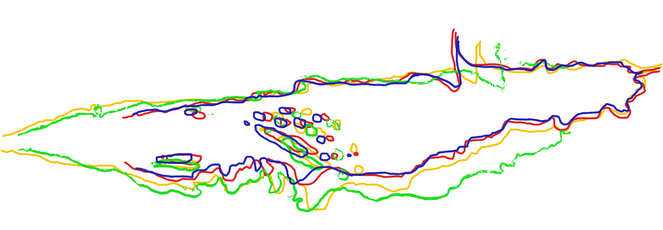
There’s another problem too. I’ve said that the one element which appears to be drawn in plan in all these maps is the lake. However, it changes shape. Clearly Ransome didn’t do what he had his explorers do in Secret Water, and make tracings of a base map to which detail could then be added over time.

The closest agreement in terms of the shape and proportions of the lake is between the maps in  Swallows and Amazons (even though this is Spurrier, not Ransome) and Winter Holiday. In Swallowdale the lake is considerably broader in proportion to its length. The Picts and the Martyrs map makes it equally wide around Rio Bay but the difference is less marked elsewhere. The Beckfoot promontory also shifts position quite markedly; in Swallowdale it’s much farther north.

Varying outlines of the lake from the four sources referred to.

Varying outlines of the lake from the four sources referred to.

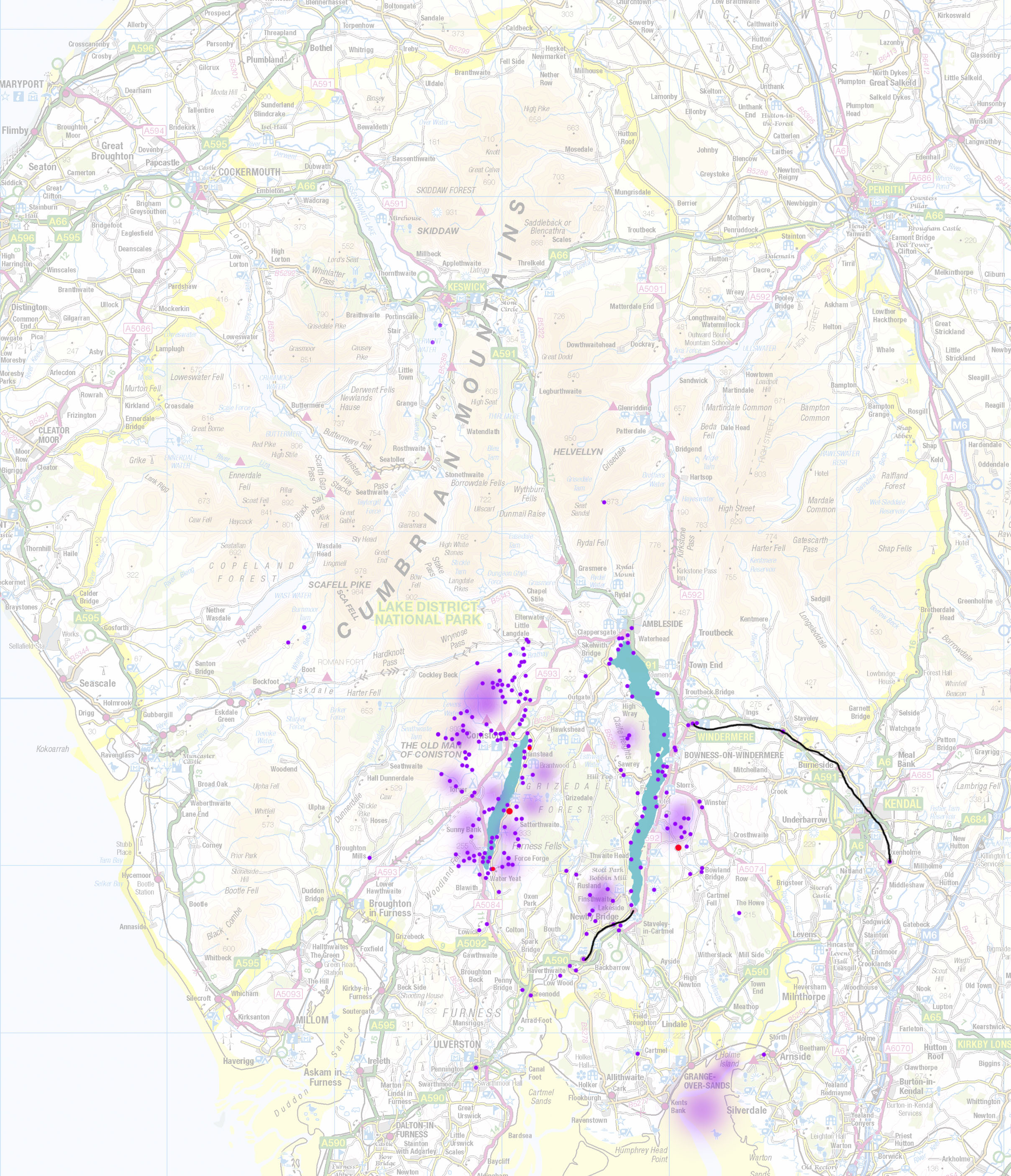
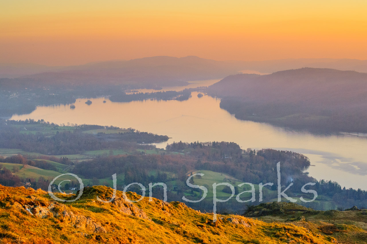
These variations, along with others already noted in Part 1, mean that even deriving the length of the lake, let alone extrapolating from this to other features, is full of pitfalls. But we took the plunge in Part 1 and concluded that it is about as long as Windermere, i.e. approx. 10 miles/16km. Based on this, is there anything we can say about the scale of other features?

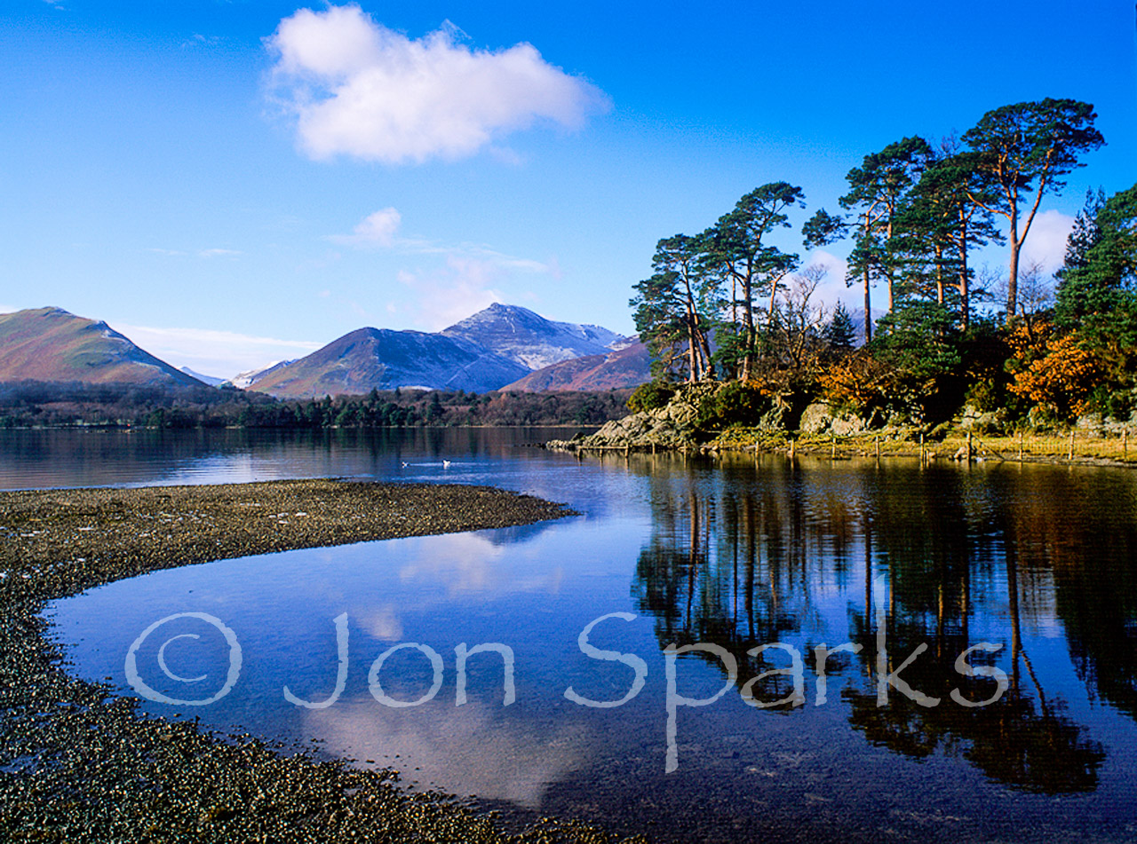
Well, there is some other firm data, not about lengths but about heights. The map in Pigeon Post gives the height of Kanchenjunga as 2600 feet. This agrees very well with the height of Coniston Old Man, today given as 803m: 2634ft in old money. Of course there’s more to be said about whether the Old Man is the sole model and there’s quite a bit about that in my book, but that doesn’t really concern us here.

Apart from this and a few other heights on the Pigeon Post map, Ransome is generally very careful not to specify measurements exactly. (It’s different in the East Anglian books, but then they use the real landscape, not an imaginary one). For example, as noted in Part 1, Wild Cat Island is ‘about a mile’ from Darien. Even before this, very early in Swallows and Amazons, he mentions looking out ‘…over mile upon mile of water’.

The same formula recurs in the first description of the Swallowdale moors: ‘mile upon mile of green and purple moorland’.

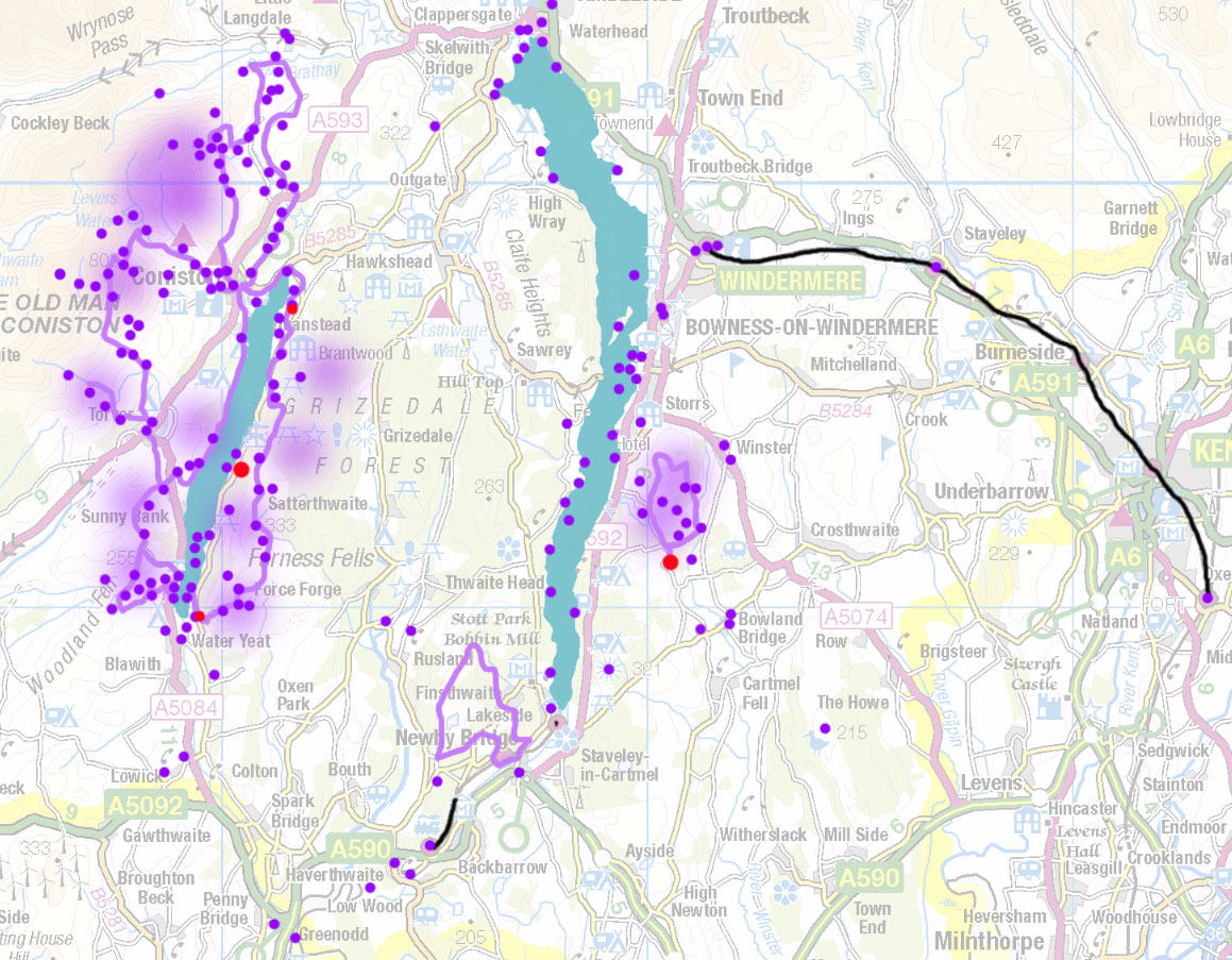
This stretch of moorland appears in the maps in both Swallowdale and The Picts and the Martyrs. In both, it appears about the same length in relation to the lake: from Swallowdale to the descent into the Amazon valley is about 60% of the lake’s length, which would make this about 6 miles/10km. And of course the moors don’t end immediately south of Swallowdale so their overall length is even greater.

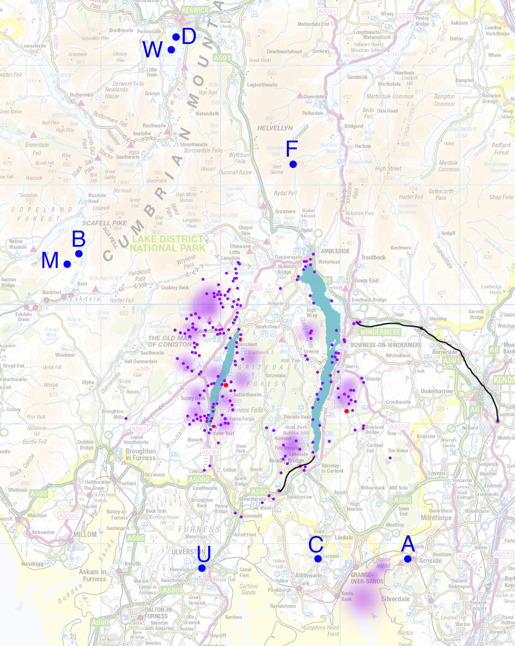
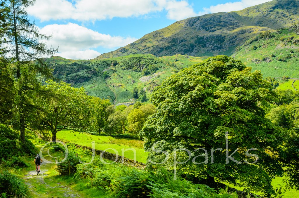
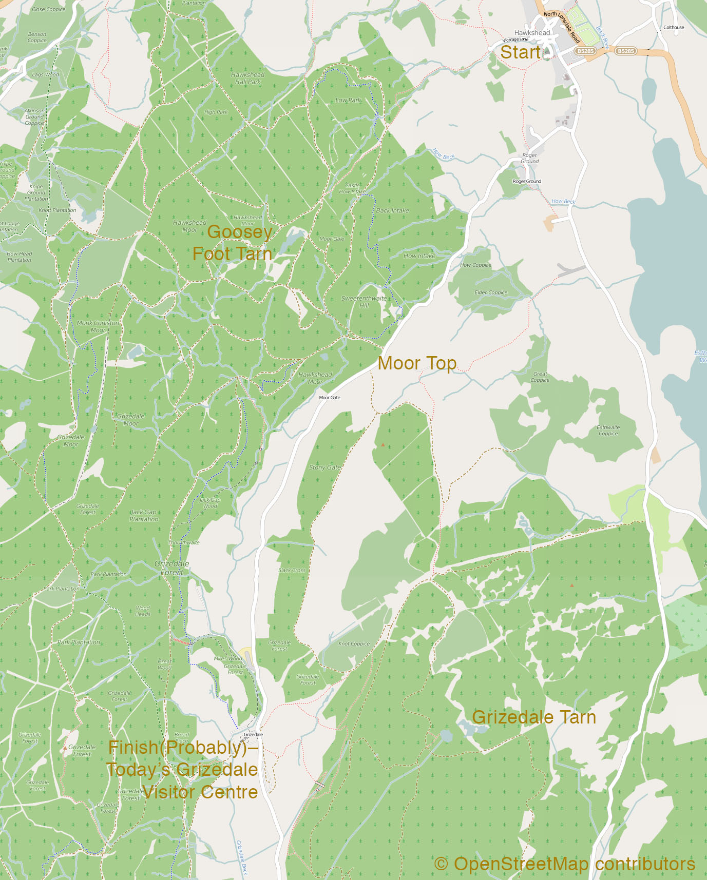
This immediately casts doubt on the claims that some people have made that the Swallowdale moors are based on the Blawith Fells, west of Coniston Water. These aren’t much more than 5km or 3 miles long. The scale of the maps fits much better with the upland east of Coniston Water; from Brock Barrow, just above Nibthwaite, to the road at High Cross, a trek of at least 8km/5 miles is certainly possible. Today, much of this land is enveloped in conifers as part of Grizedale Forest, but far more of it was open moor when Ransome came here as a boy and as a young man. For more about this, see Mile upon Mile of green and purple moorland.

Even so, 8km is not 10km. But maybe this is the place to remind ourselves that the ‘lake country’ exists in the imagination, and that not only are Ransome’s main protagonists children, many of his formative experiences, especially on land, took place when he was a child too. (Sailing, for the most part, came a little later). There is a difference in the way that children perceive the scale of the world, especially when it serves as a seedbed for the imagination.

We should also remember that the Swallows and Amazons are almost entirely reliant on small sailing vessels or their own feet to get around. Bicycles figure in Pigeon Post and cars and buses crop up occasionally, while trains are how they get to and from the lake country.  Ransome, as child and young man, was in the same position. It would take well under an hour to get from, say, Nibthwaite to Ambleside by car. On foot, it would be at least a half-day’s walk even for an adult.

And really this is the key to answering our question: How big is Ransome Country? It’s the sort of area that a group of children can get around under their own steam. And we should remember that at the start of Swallows and Amazons, Roger is just seven. In Swallowdale, he is eight. This makes the trek across the moors take on a slightly different magnitude, not to mention the return trip by Roger and Titty alone – and she is no more than ten.

We can say, baldly, that the lake is about 10 miles long. We can infer that the country on either side spreads rather less than ten miles from Kanchenjunga to High Greenland. But the mere mention of Kanchenjunga and High Greenland takes us to a different dimension. The lake is ‘as big as a small sea’ (Swallows and Amazons, Chapter 1) – or a very large one, since it also has Arctic and Antarctic regions, and in Winter Holiday there’s a North Pole to be found.

On the maps, the lake country is small enough. In the imagination it’s far, far bigger.

Naming It

I’m delighted to welcome a guest contributor to this blog. Norman Hadley is a man of many parts – among other things he’s a mountain biker and one of the main men behind pedalnorth. And he is another lover of Arthur Ransome’s work. And he just happens to be a near neighbour of mine. What are the odds of two mountain biking Ransomephiles living within a few dozen pedal-strokes of each other in a small Lancashire town?
He’s also a very fine poet. Here’s an example, reproduced by very kind permission.

Naming It

A man called Ransome

showed me how it’s not enough

to teeter out to the furthest rock

in the rush of river, that you had

to name it, had

to own it,

so when you crouched

where the wagtails pirouetted

and the river splashed your sandals

you would, making sure that

noone else could hear you, whisper,

‘Finisterre,

Finisterre.’

Stepping Stones, Eskdale. Not really Ransome country, but sometimes it's the spirit that matters...

Stepping Stones, Eskdale. Not really Ransome country, but sometimes it’s the spirit that matters…

Mile upon Mile of green and purple moorland

One of the favourite controversies among Ransome devotees is the location of the ‘real’ Swallowdale – if, indeed, there ever was one. Attached to this is the argument about which area of moorland should be taken as the original for the mile upon mile of green and purple moorland within which the secret valley lies.

"Mile upon mile of green and purple moorland". And this is just a bit of it. Bethecar Moor, looking south from Arnsbarrow Hill.

“Mile upon mile of green and purple moorland”. And this is just a bit of it. Bethecar Moor, looking south from Arnsbarrow Hill.

Given the tremendous role Roger Wardale has played in Ransome studies, I’m reluctant to disagree with him, but I certainly didn’t find his nomination for Swallowdale – Long Scars – convincing (see Exploring Arthur Ransome’s Lake District, Chapter 3). Nor do I think the moors where it lies, Blawith Fells, fit the bill, either in character or in extent – as discussed elsewhere, they’re no more than 5km/3miles long and the Swallowdale moors should be around twice that. This is borne out both by the area they occupy on some of Ransome maps, and by the length of time the Swallows take to traverse them on their way to the Amazon preparatory to climbing Kanchenjunga (Swallowdale, Ch 23, Overland to the Amazon).

I’ve always felt that the moors east of Coniston Water are a better bet, certainly in terms of character, but there isn’t really that much more open ground there today as the northern part of this bit of upland has been enveloped by the conifers of Grizedale Forest.

However, as I wrote in Exploring Arthur Ransome’s Lake District, ‘Grizedale Forest has not always been there; in Ransome’s time there was much more open country east of Coniston Water.’

When I first wrote those words, I checked against a reproduction of an OS one-inch map from 1924–25 – just a few years before Ransome began writing the stories – as well as an original Bartholomew one-inch map ‘for Motorists and Cyclists’. This is probably from 1930, the very year in which Swallows and Amazons was published. Both of these show far less extensive forest cover on the uplands east of Coniston Water.

And now I have discovered an excellent source of earlier OS mapping – the National Library of Scotland has scanned OS 6” maps of the whole of England and Wales as well, including dates relevant to Ransome studies. I’ve just looked at maps of the relevant area for 1912. This isn’t a prefect date – Ransome was mostly living in the south at the time, trying to come to terms with marriage and fatherhood, but in 1913 he decamped (some have said ‘fled’) to St Petersburg, with consequences neither he nor anyone else could have predicted (see Exploring Arthur Ransome’s Lake District, Chapter 6). However, it sits neatly between the formative years of his boyhood holidays at Nibthwaite and visits as a young man to Bank Ground and Lanehead, and the writing of Swallows and Amazons and Swallowdale in 1929–31.

These maps very clearly show that large areas of what is now forest were open ground at the time. It appears that there may have been scattered trees in places, but no dense plantations or woods. The image below shows 1912 tree cover in dark green and the contemporary extent (not allowing for temporary areas of clear-felling) in a paler shade.

The map's on its side – just like the maps in Ransome's books. In this case North is to the right.

The map’s on its side – just like the maps in Ransome’s books. In this case North is to the right.

One thing that leaps out at me is how close open moorland was to Bank Ground and Lanehead. It also appears that the area further south, Bethecar Moor, has not been covered in trees at any time in the last couple of centuries, if ever; it’s also clear in a map of 1846–8. Bethecar Moor is right above Nibthwaite, where Ransome spent many blissful holidays as a child; and it still, today, seems to me to have more of the right atmosphere for the Swallowdale moors than any other candidate.

You can explore Bethecar Moor, and many other key locations, on Walk 3 in Exploring Arthur Ransome’s Lake District. And, yes, I’ve called it High Greenland, because it could be that too. But that’s another story. Either way, there’s some fabulous walking to be had, and some of the paths are quite faint, so it can feel like real exploring. The walk also passes some of the best views in the Lake District.

Dick Callum – Pioneer Mountain Biker?

‘Meanwhile the dromedary was jolting him almost to pieces as it slipped and jumped and jibbed and skidded and bucked over the loose stones in the old path down the wood. You never would have thought it was possible to get so hot going down hill.’

Pigeon Post, Chapter XXXIII

Dick's trail might have looked a bit like this (and that's High Topps, or Yewdale Fells, in the background)

Dick’s trail might have looked a bit like this (and that’s High Topps, or Yewdale Fells, in the background)

It’s fair to say that bikes don’t have a major role in the Swallows and Amazons stories, but they do play their part – as ‘dromedaries’ in Pigeon Post. They’re also, incidentally, quite significant in the East Anglian-set The Big Six.

Still, Ransome’s description of Dick’s progress down the track suggests he (Ransome) had some experience of riding over rough terrain, long before the term ‘mountain biking’ was invented (see below) and even before the birth of the Rough-Stuff Fellowship. Of course, when he was a young man, many roads were unsealed and more like what we would call rough tracks nowadays. And people certainly took their bikes over hill tracks and even mountain passes.

Some may remember an episode of Nicholas Crane’s BBC2 series Map Man based on the Bartholomew’s Cycling Map of England and Wales (1896-1903), in which he took a period steed over a couple of Lakeland passes – Black Sail and Scarth Gap, I believe. These are in the western fells, well away from Ransome Country.

It’s certainly possible that Ransome, born in 1884, and a map-lover from an early age, would have been familiar with and perhaps used those Bart’s cycling maps. He might also have come across the writings of Walter MacGregor Robinson, better known as ‘Wayfarer’. One of Robinson’s best-known exploits was a crossing of the bare and lonely Berwyn Mountains in north-east Wales in March 1919. Wayfarer and his companions crossed in deep snow, pushing their heavy fixed-gear bikes far more than they could ride and taking four hours to cover ten miles. On a modern mountain bike, and without the snow, it’s possible in an hour or so: I know, because I’ve done it. The pass itself is now known, and not solely by cyclists, as ‘The Wayfarer’ and there’s a memorial to him at the top. I think, however, it’s fair to say that ‘Wayfarer’s prose style seems far more dated than Ransome’s.

The author starting the descent from the Wayfarer monument

The author starting the descent from the Wayfarer monument

The suggestion that Ransome knew of these exploits is conjecture, of course, but we do know that he did cycle, sometimes over long distances, as a young man, and the distinction between ‘road’ and ‘off-road’ was rather more blurred in those days. Certainly there were really no such things as specialised bikes for different types of terrain – unlike today, when even mountain bikes have many sub-categories, like ‘cross-country’, ‘trail’, ‘enduro’, ‘all-mountain’ and ‘downhill’.

And what this ultimately suggests to me is that bikes are an entirely appropriate as well as a versatile and enjoyable way of exploring Ransome’s lake country. Despite the growth of car traffic there are still some delightfully quiet lanes and there are also easy tracks, especially around Grizedale Forest. With a bit of effort, some of these lead out to some great views – the forest does, after all, lie between Coniston and Windermere, bang in the middle of Ransome Country.

If you’re up to some rougher going, like Dick, then try a ride over Claife Heights. Claife has never, as far as I know, been nominated as the model for any of Ransome’s locations (it’s more Beatrix Potter country), but it’s oozing with the right atmosphere and the tracks are great fun. Most people will tackle them on a mountain bike but if you want to get closer to the Dick Callum experience you might try crossing Claife, as I have, on a cyclo-cross bike. Of course only you can decide what your fitness and skills are up to…

Beyond that, there are many full-on mountain bike routes in the area, from the famed (or infamous) Walna Scar Road to the purpose built North Face Trail at Grizedale. Some of the bridleways in and around Grizedale, and elsewhere, are steep, rocky and decidedly (in modern parlance) gnarly. Even on a modern full-suspension bike, and with considerable experience, I treat them with respect. If Dick got down something like this on a 1930’s steel ‘girl’s bike two sizes too big for him’ – and with a pigeon basket strapped to the handlebars as well – I take my hat off to him.

A bit more gnarly (but not very): one of the descents off Claife Heights. There are easier routes – and harder ones too.

A bit more gnarly (but not very): one of the descents off Claife Heights. There are easier routes – and harder ones too.

Watch these pages for some specific suggestions of (not too gnarly) dromedary trails.

The Rough-Stuff Fellowship and the birth of mountain biking

Pigeon Post is set in 1932. The Rough-Stuff Fellowship was founded in 1955, but the term had been around for decades. As tarmac – the ‘smooth stuff’ – spread, the contrast between it and the unsealed tracks became more significant. (As the RSF’s own website says, ‘…in the very early days of cycling everything was rough stuff’.) The rapid growth in motor traffic in the 1950s was a major factor in encouraging more and more cyclists to seek out quiet byways and bridleways.

Clearly, then, off-road biking is nothing new. However, the line of descent leading to the modern mountain bike really begins in California in the 1970s. Here a group of riders began staging informal – but definitely competitive – events, speeding down mountain fire–roads and other trails on whatever bikes seemed most suitable. A key location was 784m (2571ft) Mt Mount Tamalpais in Marin County, close to San Francisco in Northern California.

Road bikes were lethal on the loose, high-speed descents; the bikes that seemed to work best were old fat–tyred ‘cruiser’ machines, affectionately referred to as ‘Klunkerz’. The first purpose–built ‘mountain’ bikes were custom–built by Joe Breeze in 1978. By 1982, mountain bikes that we would just about recognise today, like the original Specialized Stumpjumper, were appearing.

Lost in the Forest – an early adventure

I mentioned in an earlier post that I had a vivid memory, possibly from around the time I first read Swallows and Amazons, of getting lost in Grizedale Forest. Here’s that story.

We started from Hawkshead, probably after going to church in the morning. (Maybe this was one of the things that ensured the church-going habit would not survive into my adult life!). The plan, I’m sure, was to walk up to Goosey Foot Tarn. This isn’t named on modern Landranger or Explorer maps but lies at about Grid Ref  SD 338 971. I wonder if it was named on older maps or we’d been told about it by someone.

It’s only a couple of kilometres – say a mile and a half in old money – from Hawkshead and we should have found it easily enough, but clearly we went wrong somewhere. There were forest roads, of course, but there weren’t the abundant colour-coded waymarks that there are in the forest today, still less the purpose-built mountain bike trails. I dare say we – meaning my Dad – had a map, but no compass, and of course those forest roads all look rather alike.

At some point we would have eaten our sandwiches and drunk whatever we had to drink – I’m betting it was Ribena. I’m not sure we ever did find Goosey Foot Tarn. I do have a memory of stumbling across a tarn at some point, but I’ve been to Goosey Foot Tarn several times since and the one in my memory looks nothing like it.

A more recent photo of Goosey Foot Tarn

A more recent photo of Goosey Foot Tarn

In fact the one which best fits the picture in my mind is Grizedale Tarn – but unless we’d gone seriously wrong even before leaving Hawkshead (hard to see how), we’d have had to cross the road at or near Moor Top to reach it.

Today, of course, there’s a car-park at Moor Top, with information boards and maps and even a pay machine. But I guess there was none of that back then (this can’t have been later than 1970). Even so, would my parents, with two of us in tow (and my brother being four years younger than me), deliberately have crossed a road that they clearly shouldn’t have crossed and carried on regardless?

What is for sure is that we must have wandered for several hours. Unless I’ve muddled two separate occasions, we reached (Grizedale?) Tarn late in the afternoon and mist was beginning to rise. I’m sure there were some deer on the far shore too. We were all tired and thirsty and I’m sure my brother would have been carried for some of the time. I imagine it must have been starting to feel quite serious, lost in the forest with two small children in tow, evening drawing on, no torch, no spare clothing, probably no more food and drink, and no way to summon help (no mobile phones in those days!). My parents must have done a good job of hiding their concern; I knew we’d been out a lot longer than intended but as far as I can recall it all seemed like a big adventure.

However, we must have found our way reasonably directly down to what is now the main forest centre – perhaps there were one or two signs – which we reached more or less at dusk. Either there was a public phone or someone must have let us use theirs to phone for a taxi.

Out of everything that happened that day, two images really stick with me. One is a lonely tarn deep in the forest (it seemed deep and lonely then, for sure); mist rising off the still water, a couple of deer materialising from the shadows on the far side. A few years later I persuaded the art teacher at school to let me attempt a really large painting (I guess at least 4ft x 3ft, possibly bigger) on board instead of paper. I roped in a couple of friends to help me and we’d work on it at lunch breaks and after school. The scene which I drew, and which we started to fill with paint, was – as near as I could recall – that forest tarn as afternoon shaded into evening.

I think the painting was about 80% done when we got to the end of that school year. Somehow we never got going again the following year. I wonder what happened to it.

The other abiding image is seeing lights and rooftops as we stumbled down a stony track in gathering gloom. I’m sure it was a massive relief for my mum and dad, and something of that must have communicated itself to me too. It’s definitely something which still resonates with me, emerging from the untamed dark to welcoming lights.

That memory came back to me a few days before Christmas 1976 on my first ‘long’ solo walk. I’d walked from Cambridge and remember coming off the empty chalk uplands and dropping down to Saffron Walden in the gloaming. I was more into Tolkien than Ransome at that stage and it seemed very much like approaching the Last Homely House. But I thought of Grizedale too. I’ve had the same feeling many times since, coming down to an Alpine hut perhaps, or a pub like the Old Dungeon Ghyll or the Station Inn at Ribblehead. By comparison, merely rolling up to a car park, changing your footwear and driving off to somewhere else is a colourless way to end a day.

Incidentally, it would be tricky to recreate that magical approach to Saffron Walden today as the M11 now slices right through it. Which prompts the thought that it would be interesting to discuss Arthur Ransome’s environmentalism at some point…

Goosey

How big is Ransome Country? Part1: The Lake

There are various ways to measure the extent of Ransome Country. It’s easy enough to map out the extent of the locations in the ‘real’ world, but there are major differences between the real landscape and the fictional one. Most obviously, in the book there is only one lake, whereas in the real world there are two major lakes, Windermere and Coniston Water, with a minor one, Esthwaite Water, as well as a number of tarns, in between.

It’s clear enough, and generally agreed, that the lake in the novels is an amalgam of Windermere and Coniston, and I’ve suggested in my book that, “A simple summation might be that the lake is Coniston Water, chopped in half and with the middle reach of Windermere (Bowness and its islands) dropped into the gap.”

Windermere from Wansfell – almost a complete view of the length of the lake

Windermere from Wansfell – almost a complete view of the length of the lake

However, as I immediately added, “It’s never quite as simple as that with Ransome; several bays and coves along the fictional shoreline are drawn from Windermere.” And, we might add, the North Pole which appears in Winter Holiday and briefly in The Picts and the Martyrs also appears to be from Windermere.

In any case, what can we tell about the size of the lake from the maps and text of the novels? Ransome doesn’t give too much away and there are no scale markings on any of the maps. The closest he comes to giving actual measurements is in the first chapter of Swallows and Amazons, where he describes the Walkers looking out from the Peak of Darien ‘…over mile upon mile of water’. A couple of pages later he states that Wild Cat Island ‘…lay about a mile away towards the lower, southern end of the lake…’

If we take this literally, and forget the ‘about’ for a moment, what does comparing the distance from Darien to Wild Cat Island with the overall size of the lake tell us?

The most complete map of the lake, in any of the books that I have is in The Picts and the Martyrs. This shows the North Pole and reaches almost to the south end too, where the lake appears to narrow very gradually (in itself more like Windermere than Coniston).

On this map, in my copy, the north end of Wild Cat Island is 24mm from Darien and the lake itself is 214mm long. This would make the lake overall about 8.9 miles long – substantially longer than Coniston Water (about 5 miles) but smaller than Windermere (about 10.5).

_DSC0218

Coniston Water

However, while none of the other maps show the whole lake, we can compare intermediate distances. Again, we take Darien to the north end of Wild Cat Island as a mile. If we then take a measurement from Darien to the head of the lake (head of the bay below the North Pole) and divide this by the first figure we get the following results:

On the map drawn by Steven Spurrier for the first edition of Swallows and Amazons, Darien to head of lake becomes 7.65 miles. On the map in Winter Holiday it’s just about 7 miles. However, on the The Picts and the Martyrs map, it only appears to be about 5.8 miles. And as this map suggests that the distance from Darien to the foot of the lake is at least 3.1 miles, the Swallows and Amazons map makes the lake at least 10.75 miles long. On the map in Winter Holiday the implied length is just over 10 miles. In both cases this is very close to the real length of Windermere.

On all the maps the lake also appears broader, in proportion to its length, than the generally ribbon-like Windermere and Coniston Water, neither of which are anywhere wider than about 10% of their length. I’m not nerdy enough to try and work this out, but it does look as if the area of the fictional lake could be about equal to Windermere and Coniston combined.

In any case, if we take the length of the lake as being about 10 miles/16km, that gives us some sort of base-line for estimating the overall extent of the area in which the stories take place, and I’ll return to this question soon.

Get the Book

Exploring Arthur Ransome’s Lake District is available now in both iBook and Kindle versions.

Both versions contain almost 150 colour photos and two maps. Inevitably it’s a fairly substantial download and you may well want to wait until you have a good Wifi connection. Naturally the book is best viewed on a full-colour device and preferably on a good-sized screen.
If you have a choice between iBook and Kindle, I recommend the iBook version as I had much more freedom in designing the book for this platform. In my opinion the best viewing experience is on an iPad or a Mac.

Exploring Arthur Ransome’s Lake District is developed from a hardback calledArthur Ransome’s Lake District, which was published by Halsgrove books. Copies may still be available from the publisher’s website at full price (£14.99) but you can probably find it cheaper by searching online.

ransomelgePlease note I can’t supply copies of the hardback or the ebook direct. Please follow the links above to obtain copies.

For information about other books I have published see my Amazon page.